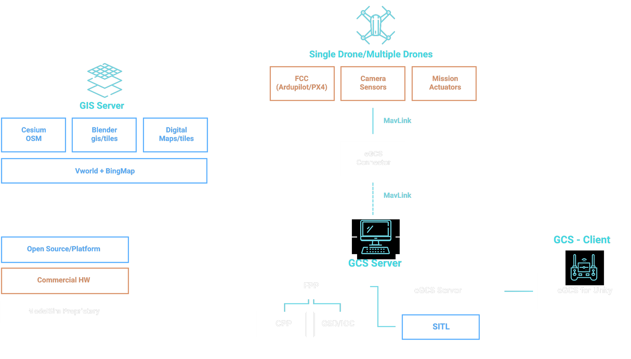
MavLink, which is the standard communication protocol in drone and UAM communities, allows compatibility with most drones and UAM’s available in the market.
MavLink
eGCS Structure
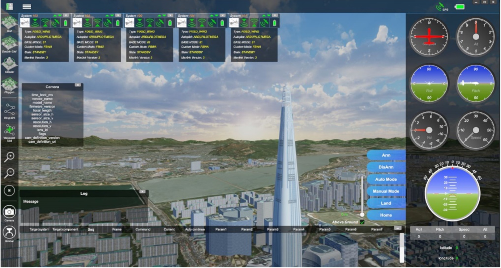
2D/3D Drone Maps
2D/3D drone maps and camera overlapping ratios, depending on flight paths, camera lens, gimbal, and terrains, can be generated and simulated using accurate physics models.
Features being deleveoped
- Labeling and recording functions of flight and mission information for analysis and debriefing
- Application of real-time weather information to flight simulation of drones and UAM’s
- Additional computer vision SW modules for facility inspection (eg. solar farms), derivation of vegetation indices, and so on.
- AI application and sensor models of IR, Lidar, and so on, in real flights and simulation
- Off-line mode for security reasons (the present GCS uses web-based GIS information)